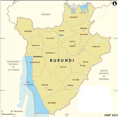
With its density of 289 inhabitants per km² against an average density of 18 inhabitants per km² in Central Africa, Burundi is among the African countries with the highest densities. Burundi is essentially agricultural country and the sector contributes roughly 40 and 60% of the GDP. Agriculture exports (coffee, tea, cotton) constitute 70% to 85% of the export revenues.
Climate in Burundi
Burundi’s climate is tropical and humid which is influenced by the altitude varying from 773 meters to 2670 meters and is characterized by alternating rainy and dry seasons. The country sits within five (5) climatic and ecological areas, namely, the low Imbo flat country, the steep mountainous area of Mumirwa, the mountainous Congo-Nile watershed area, the central plateaux and the Kumoso and Bugesera depressions.
Socio-economic activities largely depend on soil quality, temperature and precipitations in the different climatic and ecological areas. Thus, differences in the spatial and temporal precipitations and temperatures due to climate change have a negative impact on the Burundian population. The main sectors affected by climatic changes are those of energy, agriculture and livestock, forestry, water resources, natural ecosystems, landscapes and health.
Water Resources
Although Burundi is endowed with abundant water resources, its distribution is uneven and the country is experiencing increasing pressure on water resources. Climate change is most likely to induce disorders to the behavior of the hydro climatic parameters like precipitations and the flows in the rivers and lakes.
The rise of temperature is expected to cause an increase in evaporation and evapotranspiration. Increased in precipitations is expected to cause erosion on the hills and floods in low lands, thus destruction of the socio-economic infrastructures like the roads, the bridges and other public infrastructures. On the agricultural level, rainy erosion might cause arable land losses due to floods, especially for the period of long rainy seasons.
National Adaptation Action Plan
An elaboration of the possible options (to plan appropriate adaptation measures) is needed. The government of Burundi is implementing projects in climate change to help in restoring the environmental balance in order to assure the food security of the population. However, the government is challenged overall implementation of adaptation plan and strategy.
WACDEP implementation
WACDEP should focus on integrate the National Adaptation Plan of Action on climate change into development policies of Burundi. Create regional and national centers to promote a permanent framework for information exchange on climate change between scientists and decision makers. WACDEP can also focus on strengthening the capacity of the government especially support Burundi’s NAPA which is anchored in the country’s Poverty Reduction and Growth Strategy Paper and was supported by UNDP.
Other important areas of WACDEP’s focus can be the implementation of IWRM plan includes climate change adaptation measures. Set up regional mechanisms for climate observation and develop an observation system at the national level by equipping meteorological stations as well as by building human capacity and better accessing technical resources. Promote activities that increase awareness of vulnerable communities on climate change adaptation processes, and undertake the actions laid out in the National. Enhance the capability of existing institutions to act. Undertake activities formulated in the National Action Plan for integrated water resources management “PAGIRE” in Burundi.
