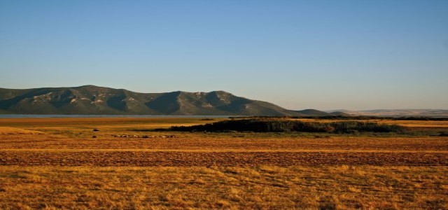
In Tunisia’s mountainous and forested north, rivers fill rarely yet ferociously, scoring the hillsides as they send their waters down to the sea. The water carries away the topsoils that sustain farmers’ crops and livestock grazing. Then follow months of drought. In the past, farmers would place riprap – or contour banks – to capture and store some of this water and avoid erosion, but that sufficed only for small-scale agriculture. Modern times, with increased commercial production of irrigated export crops such as wheat and vegetables, face more water shortages and have to address increased pollution of existing water sources from fertilisers. Climate change is adding to these challenges.
The Douimis River watershed, with flows that reach Lake Ichkeul, Tunisia’s national wetland park classified as a Ramsar Site, has become ecologically fragile due to advanced erosion. At least 46 percent of agricultural land in the area is severely eroded. The region’s farmer’s talk about the exacerbation of these forms of degradation due to climate change, referencing increasing temperatures, decreasing rainfall, and wildfires that together create conditions of hardship:
“Now there isn’t enough rain, fires have become common, droughts frequently causing a lot more work for us. We are always thirsty. We don’t have roads, which makes collecting water even more difficult. We have a well, but engineers have come to tell us that the water is not good to drink. So we had to go 15 kilometers – I went myself only to find that the source was dry. We are going to stay thirsty for the next 10 days.”
(Douimis Basin farmer)
Tunisia’s national government, which combines the responsibility for water resources management with agriculture, has recognised the region as especially vulnerable and as a priority intervention area for water and soil conservation projects.
Combining knowledge
In 2010, GWP Mediterranean initiated a demonstration project through WACDEP to support the Tunisian government’s planning for soil and water conservation in the region. This brought together a cross-section of stakeholders – scientists, farmers, local communities, and national and regional government representatives – to learn about the conditions and potential of the region, and to begin working together to help decide how best to create a sustainable future there.
GWP Mediterranean applied its understanding of the need to involve different types and levels of stakeholders from the beginning. It has established a close collaboration with the Tunisian General Department for Planning and Conservation of Agricultural Lands at the national level, and the regional Department for Agriculture Development of Bizerte at the local level. The National Meteorological Institute and the National Research Institute for Rural Water Engineering and Forestry, as national reference institutions, brought science to the project in the form of climate change models and rural development research. Facilitation groups were formed to bring the voices of farmers and community members to meetings and workshops.
The project explained climate science in language that could be understood by all; through vulnerability and risk maps, the project visualised the potential impacts and made the urgency to act jointly easy to comprehend.
Understanding relationships
While availability and quality of water was naturally an important focus for discussions, the WACDEP approach recognised the need to consider and discuss critical, related socio-economic issues such as land tenure, education, culture, and transport. Five thematic planning groups tasked the stakeholders to look at issues related to infrastructure, natural resources conservation, land tenure, human development, shared equipment, and productive sectors, coming up with practical solutions that could be included in a planning document. The groups also discussed how the government could budget for priority issues.
Building a chain of influence
Working together to deal with local problems, the stakeholders produced highly relevant recommendations that were integrated into Tunisia’s Five Year Development Plan 2016–2020. Enthusiastic local participation and contributions to the Douimis regional planning process created a model for Tunisia to use in other management plans. They also created new connections among those who participated. The process made clear that a combination of lived experience, scientific evidence, and understanding of management needs is the basis for a strong and locally relevant response to climate change.

