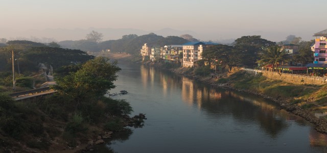
Surrounded by waterfalls, hot springs, and freshwater creeks, and living with rains that last eight months each year, the people in Thailand’s lively border town of Mae Sot understand water. Three main creeks flow through the municipality’s valley basin before converging to form the Moei River, which marks the border between Thailand and Myanmar. These waterways have always naturally flooded, but as the town has grown, the removal of riverine trees and paving of roads and parking lots areas has altered water flow courses and decreased seepage into the ground. On top of this, climate change has increased the intensity of rainfall in the region. The result is magnified flood risk, both for businesses and for the informal riverine settlements of the region’s many displaced ethnic minorities. Mae Sot’s system for warning people about oncoming floods has not kept up with this growing threat.
Under the established flood warning practice, Thailand’s Royal Irrigation Department posts official information about anticipated weather conditions and water levels on bulletin boards in local government offices. People have to go to district or municipal offices to check for warnings, and in Mae Sot, a border town of busy traders, this system is no longer working.
Mae Sot suffered its worst flood in 2012, when the Mae Sot Reservoir overflowed and, without warning, flooded more than 10 villages along the banks of the Moei River. The Mae Sot municipality was declared an emergency zone. A €2 million concrete levee that had been constructed by the municipality without consulting the community appeared to worsen the flooding. This lowered local communities’ trust in the involved government agencies, including the provincial-level Department of Disaster Prevention and Mitigation, which is legally responsible for developing the country’s disaster warning systems.
A community-driven solution
In 2014, GWP Thailand supported by WACDEP, adopted a community- based approach to bridge the gaps between the remits of the state authorities and Mae Sot’s 20 local communities. The aim was to implement a sustainable community-based flood management solution and, ultimately, to mitigate flood risk in the town of Mae Sot.
Recognising that there was a lack of knowledge about the causes of flooding in the region, GWP Thailand began its work in Mae Sot by leading programmes to educate local groups about the basin’s natural water sources, flows, and interconnected subsystem ecology. A WACDEP project team guided site visits, led surveys of waterways using a participatory geographic information system, and plotted risk and safe areas on a map. This work consolidated local understanding of different sources of flooding. GWP Thailand also assisted the community in transforming the risk mapping results into risk reduction plans.
Boundary work
GWP Thailand facilitated discussions between community members and Royal Irrigation Department authorities and also supported training simulations to promote integration and horizontal communication across key local and government actors. The programme worked with Mae Sot’s civic group to encourage the participation of and collaboration among local communities, line agencies, businesses, and academic institutions. This helped establish a network of local people committed to improving Mae Sot’s flood management strategies. The Royal Irrigation Department got involved, and the project received technical support from the Geo-Informatics and Space Technology Agency of Chiang Mai University and from the Water Resources Research Centre of Naresuan University.
The idea to use LINE, a free, mobile phone-based communication application, as the platform for the flood early warning system surfaced during this collaboration. The application provided a means of rapidly sharing community observations and enhancing real-time communication throughout the basin. Drawing on their increased awareness of flood sources and their growing capacity to assess risk, local people began to routinely monitor water levels and exchange this information via LINE, allowing for appropriate lead time to implement flood mitigation plans and preparation strategies. The shared information was also disseminated across other channels, such as community radio stations, to reach the wider public.
A meeting of minds
The Department of Disaster Prevention and Mitigation is mandated to carry out annual drills for flood disaster preparation and management in each province of Thailand. In 2014, motivated by WACDEP’s focus on local engagement, the department decided to have the Mae Sot community organise the drill in its province. All government agencies, the municipality, and sub-district administration were invited. The departmental head from the provincial office joined in. The importance of tailoring to local context was highlighted, as capacities and needs of the communities for flood disaster management were included in the drill. On the same day, the Thai Public Broadcasting Service shared the story of Mae Sot communities’ preparedness for flood disaster, live and nationwide.
Shared knowledge, inclusive planning
This cooperation marked an official turn towards community-based flood disaster management in Mae Sot. National authorities agreed to provide regularly updated information to the flood early warning system platform, especially during high-risk periods.
GWP Thailand’s facilitation of discussions between community members and government authorities transformed how water policy is implemented in Mae Sot. Never again would the municipality repeat a project such as the €2 million concrete levee that neglected local inputs on how Mae Sot’s water subsystems operate, leading in turn to exacerbated flooding. Since then, the municipality has engaged community members in reviews of water management project proposals, calling on their local knowledge to help shape flood mitigation strategies.
Mae Sot’s flood early warning system benefits a population of at least 200,000 people. Through WACDEP, GWP Thailand opened up multidirectional flows of knowledge among the region’s water stakeholders, ensuring that science at the national and provincial levels will be available to local communities and that local people’s knowledge will drive the design of municipal initiatives.

